Riverfront Canal Cruises

Enjoy a Canal Cruise Along the Kanawha Canal in Downtown Richmond
Looking for fun and unique things to do in Downtown Richmond?
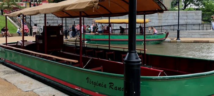
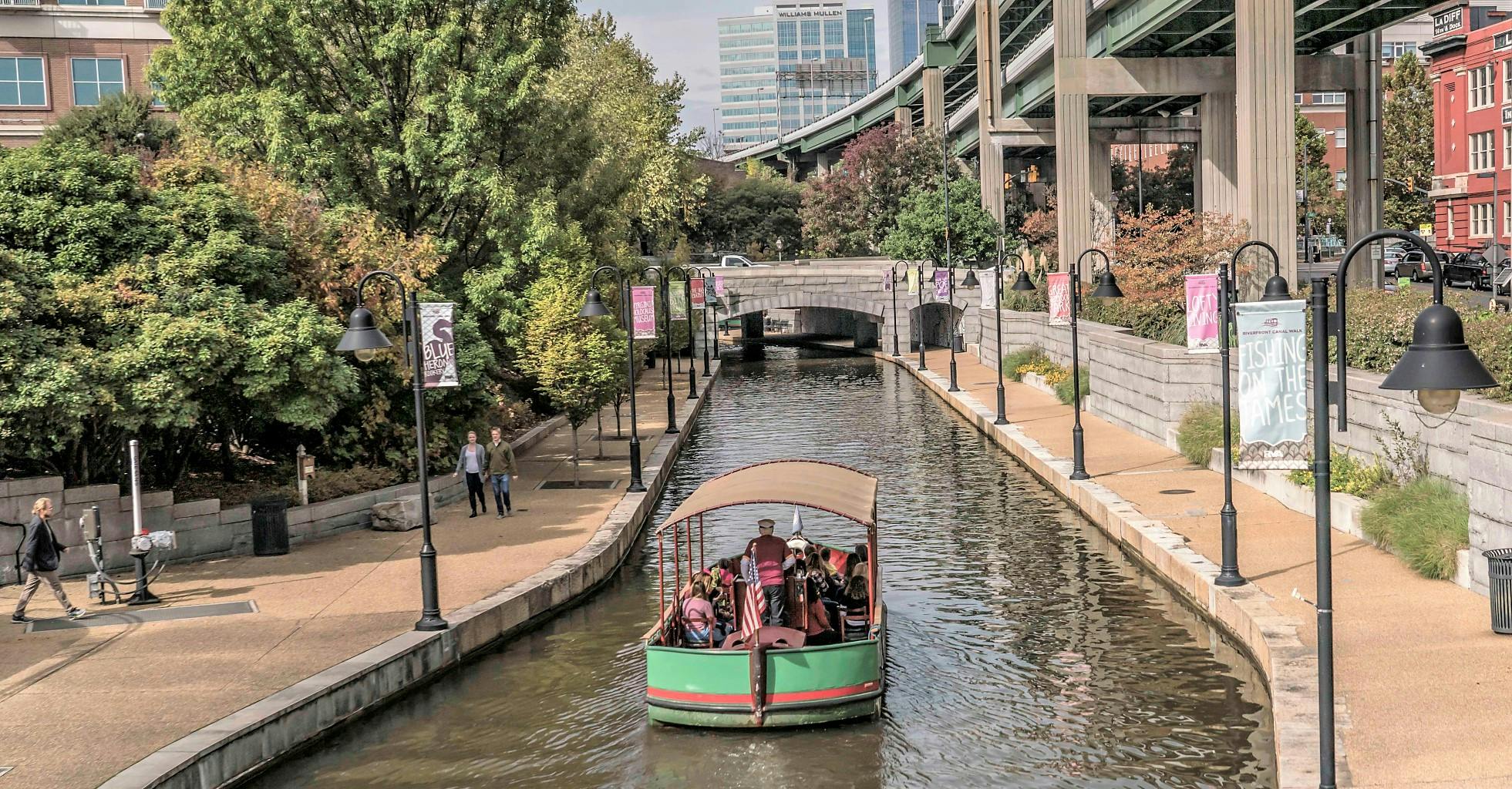
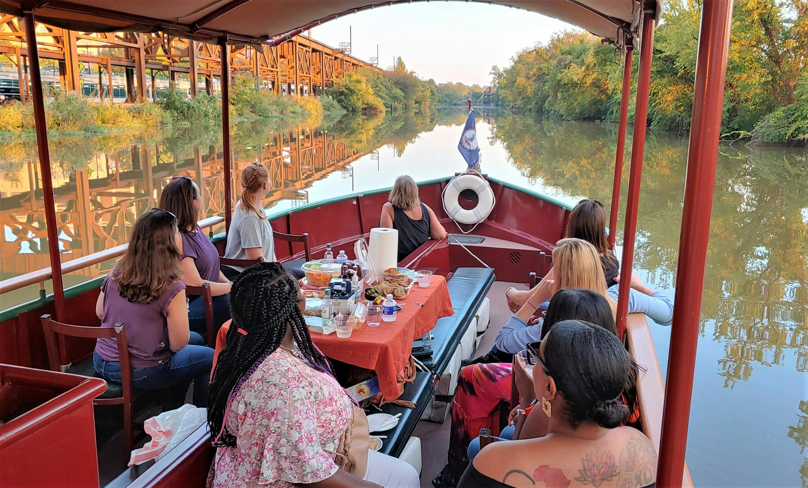
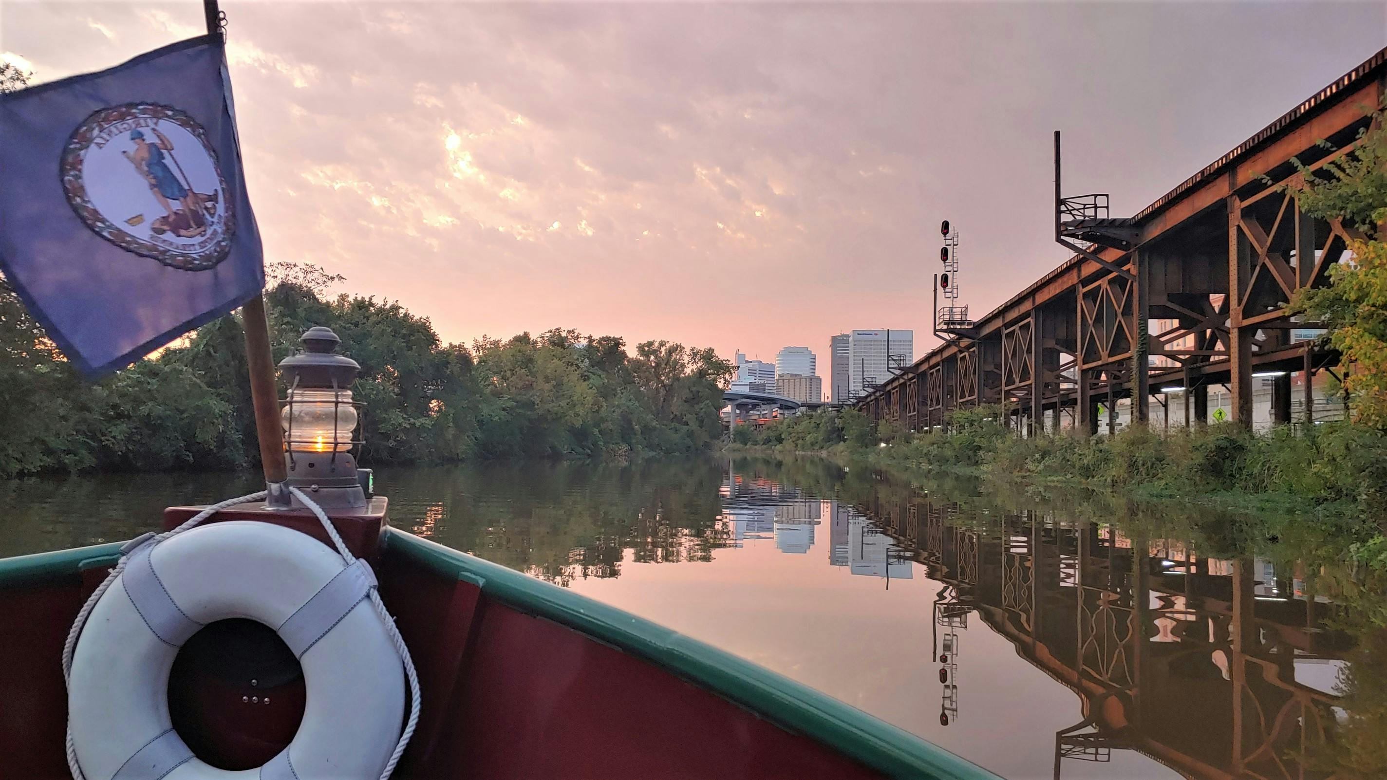
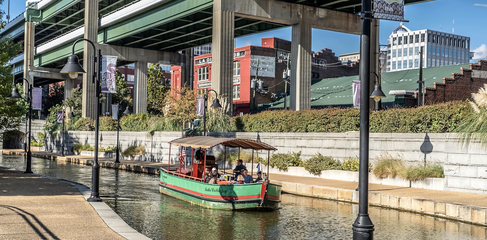
The boat tours travel through the historic James River and Kanawha Canal along Downtown Richmond's Canal Walk. Narrators review centuries of Richmond’s history, from Powhatan’s Chiefdom to the first commercially successful electric streetcar in the world, all while traveling in authentically styled boats. Visitors will see the unique railroad Triple Crossing, historic 19th century architecture, the Virginia Capital Trail, the Low Line gardens and James River wildlife.
Hourly Historic Tours
40-minute historically narrated tours
The canal boat tours of the James River and Kanawha Canal operate throughout the season, seven days a week from May through October, and with varying hours in April and November.
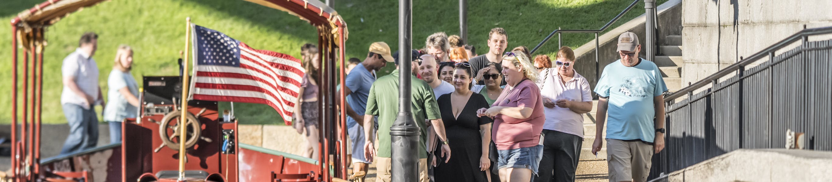
- Tours depart on the hour from the Canal’s Turning Basin at 139 Virginia Street, in Downtown Richmond, Virginia.
- Tickets are sold on a first come, first served basis at the Turning Basin’s ticket kiosk and online up to 18 hours in advance - HERE.
- Boats can accommodate up to 25 passengers and are accessible to those with physical disabilites.
- No pets are allowed except for registered service animals.
PLEASE NOTE: Even when it appears that tickets may be sold out online, we do still keep a number of walk-up tickets available at the ticket kiosk for each historic tour. Try arriving early or calling 804-649-2800.
BOAT TOUR HOURS
April
Thursday–Saturday: Noon–7PM
Sunday: Noon–5PM
May – September
Monday–Friday: Noon–7PM
Saturday: 11AM–8PM
Sunday: 11AM–7PM
October
Monday–Saturday: Noon–6PM
Sunday: Noon–5 PM
November
Friday – Sunday: Noon – 5PM
Last day of the 2025 season is November 9.
RATES
- Adults: $15
- Children (5 - 12 years old): $8
- Children 4 and under: FREE
- Seniors (65 years and up): $8
DISCOUNTS
- $1 off historic tour tickets to all teachers, first responders, healthcare workers and military personnel who show a valid work I.D. at the ticket kiosk.

Special Historic Tours
40-minute, narrated tours with special guests offering a different narration
SPECIAL TOUR HOURS
Every Thursday at 6:00pm; May 8 through July 10.
SPECIAL TOUR RATES
Same pricing as historic tours.
Thursday, July 3
6:00pm tour: Examining the complexities of freedom and independence in American history with the Black History Museum and Cultural Center of Virginia
Examining the complexities of freedom and independence in American history. Guests will learn about the museum’s exhibitions, the evolution of Richmond’s African American communities, and how the promise of liberty was delayed for many, even after July 4, 1776. The tour will highlight the resilience and contributions of African Americans who fought for freedom in every era, providing a thoughtful and enriching perspective on what independence has meant—and continues to mean—for all Americans.
Thursday, July 10
6:00pm tour: Dr. James Scow, Dept. of History and Philosophy, Virginia State University
There is a long tradition in philosophy that says what you experience is shaped by how you think. On this tour, guests will be asked to re-imagine and re-experience Richmond, the Kanawha Canal, the James River, bateaus and packet boats, and more through tropes, including water is the source of all things (Thales); water as the way (Laozi); you cannot step into the same river twice (Heraclitus); the ship of Theseus; and more. Exploring these tropes will enable us to re-visit the experiences of three important groups in early Virginia: the Africans who debarked at Point Comfort, the English settlers at Jamestown, and the Powhatans along the James River waterway and its tributaries.
Richmond Private Charters
Private Charters are the perfect outing for field trips, celebrations and family gatherings.
Canal Cruise private charters are also available as one- to two plus-hour private boat tours that are a favorite for family reunions, celebrating birthdays, engagements, corporate retreats, business groups, churches, clubs and so many more group outings. Private charters may be scheduled for any day and time during the season, but must be reserved a minimum of two weeks in advance.
Customers may choose for their boat ride to be historically narrated, or they can choose to forgo the historic narration and take in the sights while listening to light music over a provided speaker or simply conversing with their fellow guests. The boats can be outfitted with tables of various sizes that can accommodate light refreshments or a more formal, catered meal (catering is not provided by Riverfront Canal Cruises).
Private Charter Pricing and Guidelines
Your chartered boat(s) may be set up in one of the following (3) configurations:
- Dining style has tables and chairs, seating a maximum of 20 passengers.
- Cocktail style has chairs, benches and a small table, seating a maximum of 22 passengers.
- Excursion style has chairs and benches, seating a maximum of 25 passengers.
RATES
- $165 per boat / per hour
- $130 per boat / per hour for seniors and non-profits/educational groups
- A 15% gratuity for your guide is recommended
The 32-foot-long boats are covered with a canopy to protect riders from the weather, but we recommend that all passengers check the weather the day of and dress accordingly. The boats are handicapped accessible and can accommodate up to two wheelchairs.
Charters may be scheduled for any day and time during the boating season, are dependent on weather conditions and are scheduled on an individual basis, subject to availability.
Please book charters a minimum of two weeks in advance. Once scheduled, cruises can be canceled up to 7 days in advance without penalty. All reservations must be made online.
You may hire your own caterer or bring your own food and beverages on your private charter. Riverfront Canal Cruises requires compliance with all applicable Virginia ABC laws and regulations for all private charters that bring alcohol. Unless you have hired a caterer to provide alcoholic beverages, this is likely to include obtaining your own banquet license. Information about the laws and the banquet license application are available on the Virginia ABC website. We do not hire caterers, serve or set up food and beverage service for private charters. We do, however, set up the tables and chairs/benches on the boats in advance of your charter.
Interested? Schedule online now!
Questions? Email canal@venturerichmond.com or call our ticket kiosk at 804-649-2800.
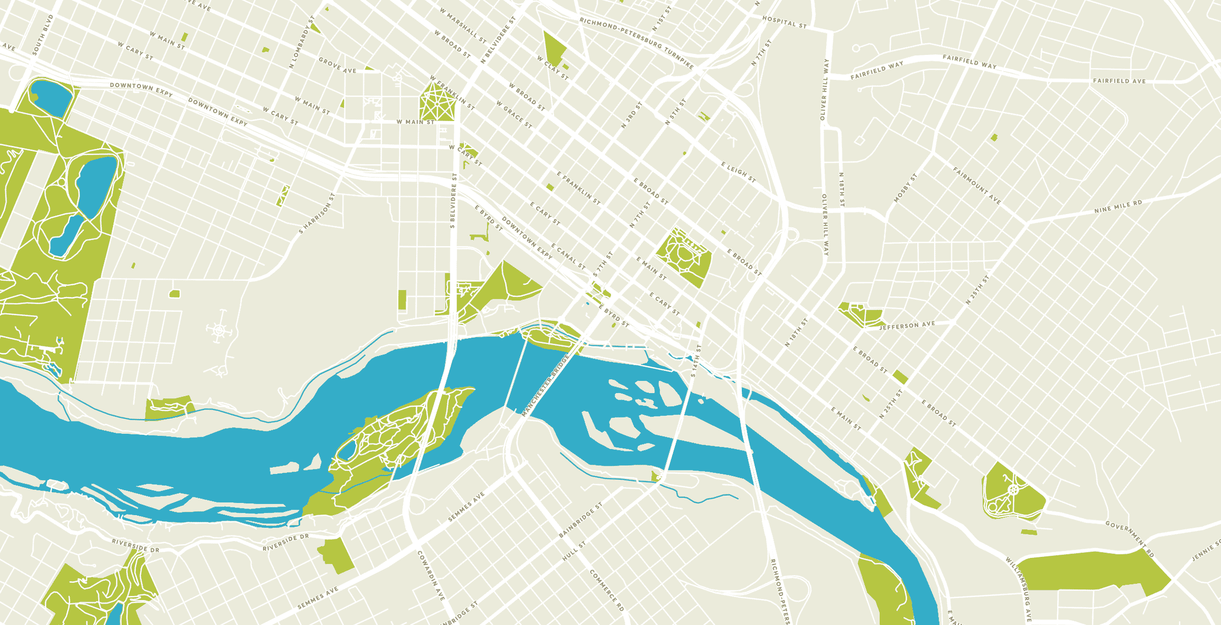
Directions to Riverfront Canal Cruises
Canal Walk Turning Basin
Address: 139 Virginia St, Richmond, VA 23219
Parking Garage and Lot Locations Nearby
All of these locations are pay-to-park
- East Cary and Virginia Street parking deck (fronting Virginia St)
- Surface parking lot along the Flood Wall between Virginia Street and 12th Street
- 14th and East Cary Street parking deck
- 12th and Canal Street parking deck
- Omni/James Center parking deck (underground, limited space) at 12th and East Cary Streets
- 15th and East Cary Street surface lots
360° Virtual Field Trip Video
Riverfront Canal Cruises has released a new 360° video featuring a virtual canal boat tour with a historical narrative. The narration touches on the SOLs for Virginia Studies and U.S. History to 1865, assisting 4th and 5th graders as they complete the school year in a fun way!